Traffic congestion has evolved from a local urban inconvenience into a massive economic burden, with global costs reaching hundreds of billions of dollars annually. The United States trucking industry alone incurs $108.8 billion in congestion-related costs—a 15% increase from the previous year—while the UK economy loses £7.7 billion annually and four major Indian metropolitan areas lose $22 billion combined. Beyond financial costs, congestion imposes hidden productivity penalties: an unskilled worker in India loses between ₹7,200-₹19,600 annually to congestion, while entire metropolitan areas experience millions of productive hours sacrificed to traffic delays.
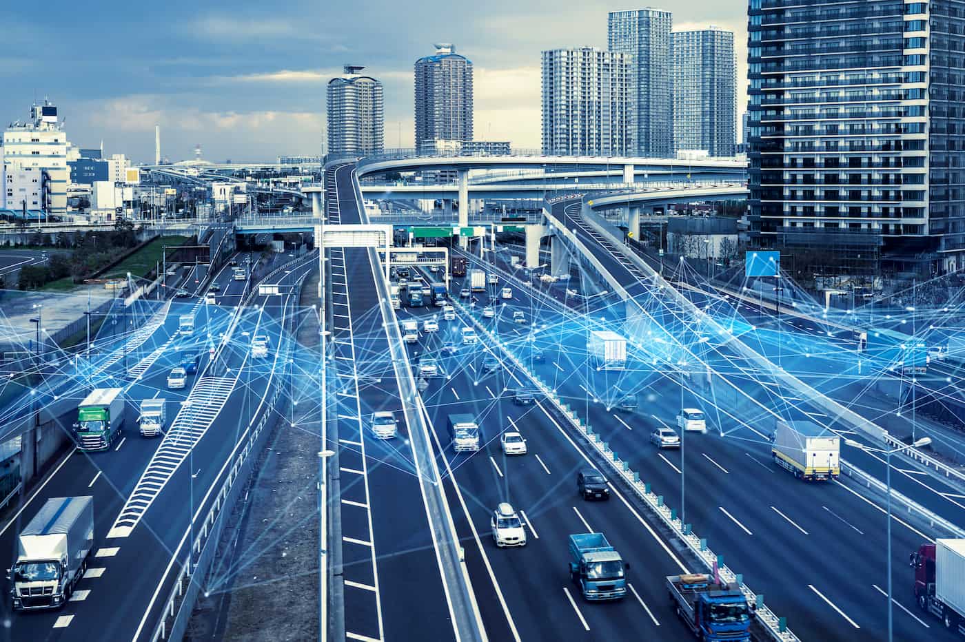
Big data technologies are fundamentally transforming traffic management from reactive, static systems into intelligent, adaptive networks that optimize flow in real time. Modern cities deploy thousands of sensors, cameras, and GPS tracking devices generating petabytes of real-time traffic data that machine learning algorithms analyze to predict congestion before it forms, dynamically adjust traffic signals to match demand, and guide vehicles toward optimal routes. The results prove compelling: Los Angeles’ adaptive signal system achieved 32% reduction in intersection delays while cutting citywide emissions by 3%; Pittsburgh achieved 20% congestion reduction through big data analysis; San Francisco’s intelligent corridor systems extend green phases for buses while maintaining overall network efficiency. China’s large-scale deployment of adaptive signals across 100 cities achieved 11% peak-hour trip time reduction, equivalent to saving nearly 80,000 cumulative hours daily.
The global traffic management systems market, valued at $2.147 billion in 2025, is projected to reach $4.083 billion by 2032, reflecting accelerating adoption of AI-powered systems that can reduce congestion by up to 30%, improve productivity by up to 80% through automation, and generate savings totaling $277 billion globally. However, realizing this potential requires overcoming substantial challenges: the infrastructure costs are enormous ($1.48 billion for comprehensive implementation across 100 Chinese cities alone), technical complexities demand sophisticated sensor networks and processing infrastructure, privacy concerns require robust governance frameworks, and implementation barriers include data integration challenges and legacy system incompatibilities.
The Economic Catastrophe of Traffic Congestion
Traffic congestion represents an understated but economically catastrophic problem affecting every major economy globally. The most precisely quantified impact comes from the trucking industry, where the American Transportation Research Institute documented $108.8 billion in annual congestion costs as of 2022—a figure representing the cumulative effect of delayed deliveries, fuel consumed during idle periods, and vehicle wear accelerated by stop-and-go driving. This cost translates concretely into 430,000 commercial truck drivers sitting idle for entire work years, and averages $7,588 in congestion-related costs per registered combination truck annually.
The geographic concentration of congestion costs proves striking. The ten most affected U.S. states account for over 52% of total trucking congestion costs, with Texas leading at $9.17 billion, California at $8.77 billion, and Florida at $8.44 billion. Individual metropolitan areas exhibit devastating impacts: New York City alone experiences $6.68 billion in annual congestion costs, Miami $3.20 billion, and Chicago $3.14 billion. These figures represent value destruction at massive scale—economic output that could have been generated if vehicles moved freely instead of idling in traffic.
The United Kingdom faces comparable burdens. The 2024-2025 INRIX Global Traffic Scorecard documents £7.7 billion in annual congestion costs to the UK economy, translating to £581 per driver per year and representing an average 62 hours of lost time. For individual workers, this translates into thousands of pounds in opportunity cost—time that could have been spent productively instead of trapped in traffic.
Developing economies experience even more severe productivity impacts relative to income levels. India’s Economic Survey documented that traffic congestion in the country’s four largest metropolitan areas (Delhi, Mumbai, Bengaluru, Kolkata) costs approximately $22 billion annually. At individual worker level, the impact varies dramatically by skill level: unskilled workers lose between ₹7,200-₹19,600 annually to congestion (significant relative to annual income), while highly skilled workers lose ₹9,000-₹25,900 annually in lost work hours. Bengaluru city alone lost an estimated 7.07 lakh productive hours in 2018 due to late arrivals from traffic congestion, valued at approximately ₹11.7 billion.
These economic costs extend beyond direct time loss to encompass cascading effects: fuel consumption increases in stop-and-go traffic, vehicle maintenance accelerates under congestion conditions, air quality deteriorates affecting health, and worker stress increases with unreliable commute times. The true economic cost of congestion vastly exceeds the direct measurements, suggesting the total burden approaches trillions of dollars globally.
Big Data Infrastructure: Sensing, Collection, and Integration
The technical foundation enabling intelligent traffic management comprises three integrated layers: ubiquitous sensor networks capturing real-time conditions, cloud computing infrastructure processing massive data streams, and machine learning algorithms transforming raw data into actionable intelligence.
Modern traffic management systems deploy thousands of heterogeneous sensors throughout urban networks. London’s Transport for London manages 6,000 traffic signal sites, 1,500 CCTV cameras, and numerous embedded sensors providing continuous visibility into traffic conditions across the entire city. These sensors collectively capture vehicle volumes, speeds, and directional flows at millisecond granularity. GPS data from navigation apps and fleet tracking systems provides probe-level information on actual traffic speeds across road networks. Weather stations measure precipitation, wind, and visibility that impact driver behavior and traffic flow. Integration of non-traffic data—construction schedules, special events, school calendars, weather forecasts—provides contextual information that influences traffic patterns.
The data volumes involved are staggering. A single congested city generates petabytes of data daily across all sources, requiring distributed processing architectures spanning edge computers (on roadside sensors), local processing centers, and cloud infrastructure for historical analysis and model training. The challenge exceeds data volume to encompass velocity—decisions about signal timing must occur in real time, measuring success in milliseconds between detecting a traffic change and triggering a responsive system change.
Data quality presents persistent technical challenges. Sensor failures occur unpredictably; camera occlusion from rain, snow, or fog degrades optical systems; GPS signals become unreliable in urban canyons; sensor calibration drifts over time requiring continuous maintenance. Rather than relying on single data sources, sophisticated systems employ redundancy and validation—comparing multiple sensor modalities, checking for outliers, flagging anomalies that likely represent sensor failures rather than genuine traffic conditions. Hybrid prediction frameworks combine data-driven machine learning predictions with model-based simulations, enabling systems to maintain accuracy even when prediction failures occur.
Adaptive Traffic Signal Control: The Cornerstone Technology
Adaptive traffic signal control represents the most mature and widely deployed big data application for congestion mitigation. Traditional pre-timed signals assign fixed green times based on historical averages—perhaps 60 seconds green time for the primary direction during peak hours—regardless of current traffic demand. This rigidity creates profound inefficiencies: when actual demand deviates from historical patterns, vehicles queue unnecessarily while green phases cycle unavailingly through low-demand directions.
Adaptive signals invert this paradigm by measuring real-time traffic queuing through embedded sensors and cameras, then dynamically adjusting green time allocation to match current demand. If sensors detect heavy traffic building in the northbound direction, the system extends the north green phase and compresses the cross-direction green time. As conditions change, the system adjusts continuously—not every second but multiple times per minute, responding to actual traffic flow rather than assumptions baked into fixed timing plans. The result is dramatically improved traffic progression: vehicles experience continuous forward movement rather than stop-and-go patterns, fuel consumption decreases, emissions decline, and travel times improve.
The effectiveness of adaptive systems scales with deployment breadth. China’s comprehensive study across 100 cities demonstrates that adaptive signal control reduces peak-hour trip times by 11% when deployed citywide, equivalent to saving 79,695 cumulative hours daily across these cities. Critically, the benefits display a logarithmic relationship with deployment percentage—deploying adaptive control at the highest-traffic 20% of intersections captures approximately 8% of the citywide benefit, but deploying at 100% of intersections achieves the full 11% reduction. This nonlinear relationship suggests a sensible prioritization strategy: cities should focus deployment on high-traffic intersections first, capturing substantial benefits from concentrated investment, then expand to lower-traffic locations for incremental gains.
The infrastructure and economic determinants influencing adaptive signal effectiveness are instructive. Cities with higher baseline congestion levels experience greater improvement potential, suggesting that congestion mitigation strategies are most beneficial precisely where congestion is worst. Conversely, cities that already operate relatively smoothly show less room for improvement. Urban design factors matter critically: cities with well-designed grid street layouts show greater optimization potential than cities with irregular street patterns, because regular grids enable more efficient flow of diverted traffic. Higher-income cities (measured by GDP at purchasing power parity) achieve greater optimization gains, likely because wealthy cities invest in complete sensor networks and modern signal infrastructure that can implement adaptive control, while lower-income cities rely on older fixed-timing signals.
The cost-benefit analysis for adaptive signals proves compelling. Comprehensive deployment across 100 Chinese cities required approximately $1.48 billion in initial setup and ongoing maintenance costs. Against this investment, the benefits include substantial emissions reductions (the full co-benefit of cleaner air and lower health costs) and travel time savings (79,695 hours daily saved across these cities alone). In many cases, the emissions reduction benefits alone exceed the investment cost when properly monetized. This finding contradicts conventional wisdom that treating environmental benefits as secondary; in the traffic context, environmental improvements often represent the dominant benefit of adaptive signal deployment.
Predictive Analytics: From Reactive to Proactive Traffic Management
While adaptive signal control optimizes for current traffic conditions, predictive analytics systems forecast future congestion, enabling proactive interventions before congestion forms. Machine learning models trained on years of historical traffic data learn seasonal patterns (January traffic differs from August), temporal patterns (8am Monday differs from 8am Friday), and event-specific patterns (Super Bowl Sunday traffic, school opening day). Current real-time traffic conditions feed into these historical models, enabling algorithms to predict what traffic will look like 5, 30, or 60 minutes in the future with meaningful accuracy.
Google Maps exemplifies the sophistication of modern traffic prediction. The system analyzes decades of historical traffic patterns—what typical speeds appear on specific roads at specific times—combines this with current live traffic conditions from billions of users sending location data, and applies machine learning to generate predictions accounting for non-obvious correlations. The model learns that rainfall increases congestion more on some roads (those prone to water accumulation) than others; that construction projects in one location create cascading delays in distant areas; that unusual patterns warrant investigation (perhaps a major accident is occurring).
The prediction horizon matters critically for operational utility. Predictions 5-10 seconds ahead enable only minimal response (vehicles are already committed to current paths). Predictions 30-60 minutes ahead enable substantial operational changes: rerouting traffic before congestion occurs, adjusting signal timing in advance, alerting transit agencies to prepare for surges, recommending alternative routes to drivers through navigation apps. The machine learning challenge involves identifying which variables matter—thousands of features could potentially influence traffic—and learning nonlinear relationships between variables that simple statistical approaches cannot capture. Deep learning neural networks excel at this task, discovering subtle patterns that human analysts might overlook.
Hybrid prediction frameworks represent a sophisticated evolution addressing the challenge that prediction models sometimes fail catastrophically. The SMURP framework (Simulation Machine-learningization for Real-time Prediction) combines data-driven prediction (primary method) with model-based simulation (fallback). When the data-driven model’s output seems unreliable (detected through anomaly detection), the system supplements with model-based predictions simulating traffic flow under the observed conditions. This hybrid approach achieves superior accuracy in edge cases where pure data-driven models struggle.
The operational response to predictions involves coordinated interventions: dynamic message signs alert drivers to upcoming congestion, recommending they delay travel, use alternative routes, or use alternative transportation modes; traffic signal retiming adjusts timing plans in advance of predicted congestion to maximize throughput; rerouting algorithms suggest alternatives to navigation apps; transit agencies deploy extra capacity on predicted high-demand routes. The effectiveness depends entirely on prediction accuracy and the timeliness of driver responses.
Real-World Success Stories: From Laboratory to Large-Scale Deployment
The theoretical promise of big data traffic optimization has been validated through multiple large-scale deployments demonstrating quantifiable congestion reduction.
Los Angeles ATSAC System represents one of the world’s largest-scale deployments. Launched originally for the 1984 Olympics with just 118 signals, the system has grown to manage 4,850+ adaptive traffic signals across Los Angeles. Using data from thousands of sensors and cameras, ATSAC continuously adjusts signal timing based on real-time traffic conditions. The results prove substantial: intersection delays have dropped 32%, and citywide emissions decreased 3%—meaningful improvements resulting from the compounding effect of millions of optimized traffic decisions daily.
San Francisco’s Connected Corridor Pilot demonstrated that intelligent signal coordination can prioritize specific transportation modes. The pilot deployed IoT and LiDAR sensors at 10 intersections to detect traffic composition, identify buses, and dynamically extend green phases for transit vehicles without disrupting other traffic. This selective optimization recognizes that buses carry 40-60+ passengers while cars carry 1-2; optimizing for bus movement achieves more efficient overall network use than optimizing for vehicle count.
Pittsburgh’s Big Data Analytics Approach analyzed years of traffic patterns to identify recurring congestion events and infrastructure improvements that would reduce them. The comprehensive approach achieved 20% congestion reduction and 20% carbon dioxide emissions reduction—substantial improvements demonstrating that thoughtful data analysis can identify high-impact interventions.
London’s SCOOT System (Split Cycle Offset Optimization Technique) dynamically adjusts signal timing at Transport for London’s 6,000+ signalized intersections based on real-time data from 1,500+ cameras and extensive sensor networks. The system continuously processes traffic information, adjusting signal coordination to optimize network-wide flow rather than optimizing individual intersections in isolation. London’s combination of sophisticated infrastructure and algorithmic optimization delivers congestion reduction and improved journey times across the capital’s transportation network.
Barcelona’s Integrated Approach deployed not only traffic signals but also parking optimization systems using sensors detecting available parking spaces. The city’s Smou app integrates real-time parking data with traffic flow optimization, guiding drivers directly to available spaces rather than forcing them to circle searching for parking. The system paid for itself within six months of operation while improving traffic flow and reducing emissions from vehicles wasting fuel searching for parking.
Singapore’s Intelligent Transport System integrates real-time data analytics with predictive modeling and adaptive signal control across the entire city-state. Singapore’s combination of high-tech infrastructure, compact geography, and political commitment to efficiency enables integrated traffic and public transit optimization delivering reduced congestion and improved commuter experience across the city.
Fleet Telematics: Decentralized Optimization Opportunities
While city-wide traffic management optimizes aggregate flow, fleet telematics systems optimize individual fleet operations through detailed vehicle tracking and analytics. Telematics platforms connect fleet vehicles to centralized systems, continuously streaming data on location, fuel consumption, driver behavior, and vehicle maintenance status. This granular data enables multiple optimization opportunities.
Route Optimization represents the most direct application. Historical delivery times, current traffic conditions, and customer preferences feed into algorithms that generate optimized routes reducing fuel consumption by 10-20%, lowering labor costs through faster deliveries, and improving customer satisfaction through more reliable delivery windows. Rather than dispatchers manually building routes (prone to errors and suboptimal choices), algorithmic optimization discovers nonintuitive but more efficient combinations of stops that human operators would miss.
Predictive Maintenance leverages vehicle diagnostic data to anticipate component failures before they occur. Engine diagnostics signal fuel injector degradation weeks before failure; brake wear sensors predict pad replacement need days in advance; transmission temperature patterns indicate emerging hydraulic issues. By replacing components proactively rather than waiting for failures that disable vehicles mid-route, fleet operators avoid costly emergency repairs, minimize vehicle downtime, and maintain higher operational efficiency. Research suggests predictive maintenance reduces maintenance costs by 20% while improving vehicle availability.
Driver Behavior Analytics analyze GPS data and vehicle sensors to identify dangerous or inefficient driving patterns: speeding, harsh braking, rapid acceleration, excessive idling. Behavioral feedback (alerts to drivers showing their patterns, coaching on safer techniques, incentives for improvements) reduces accident rates, insurance costs, and fuel consumption simultaneously. A single percentage-point improvement in fuel efficiency across large fleets translates to millions of dollars in annual savings.
Real-World Impact was demonstrated by a major cargo logistics operator managing 10,000+ vehicles through a 24/7 command center. Implementation of telematics analytics achieved 20% turnaround time reduction within six months and 10% operational efficiency improvement—substantial gains that translate into higher throughput for the same equipment and labor costs.
Congestion Pricing: Using Market Mechanisms and Data for Demand Management
While technological optimization maximizes flow of existing traffic, congestion pricing uses market mechanisms to reduce demand during peak periods, preventing congestion formation. Singapore’s Electronic Road Pricing (ERP) system automatically charges vehicles passing under toll gantries during peak hours, with charges adjusting dynamically based on current congestion levels. London’s Congestion Charge requires daily fees for vehicles entering central London during weekday peak hours. Both systems demonstrate that pricing can regulate traffic demand without disrupting traffic flow—automated systems charge vehicles electronically without requiring toll booths that would themselves cause congestion.
The mechanism is straightforward: pricing makes visible the true cost of peak-hour driving (which includes not just the vehicle’s direct expenses but also the external cost of congestion imposed on other drivers). When drivers face dynamic pricing reflecting current congestion, many respond by shifting travel to off-peak hours, using alternative transportation modes, or rerouting to less-congested corridors. The result is reduced peak-hour traffic demand, which prevents congestion formation entirely—a more efficient outcome than allowing congestion to form, then spending resources managing it.
The revenue implications are significant. London’s Congestion Charge generates hundreds of millions of pounds annually that are reinvested in public transportation improvements, creating a virtuous cycle where pricing funds service improvements encouraging modal shift away from private vehicles. India’s Economic Survey recommended adopting congestion pricing combined with parking reforms in major metropolitan areas, estimating that properly designed pricing could materially reduce congestion while generating revenue for transportation investment.
The critical requirement for viable congestion pricing is technology enabling automated payment without traffic disruption. Decades ago, congestion pricing required physical toll plazas causing their own congestion and long delays. Modern systems use ANPR (Automatic Number Plate Recognition), RFID transponders, or smartphone-based payment enabling instantaneous charging as vehicles pass designated locations. This technological enablement is itself a big data application—processing thousands of transactions per minute, matching vehicles to payment accounts, detecting violations, all with minimal traffic impact.
Market Growth and Future Trajectory
The global traffic management systems market, valued at $2.147 billion in 2025, is projected to reach $4.083 billion by 2032, representing 6.5-7% annual growth. This growth reflects accelerating deployment of AI-powered traffic management systems, with adoption driven by documented congestion reduction benefits, increasing urbanization pressuring existing road capacity, and technological maturation making systems more affordable and easier to implement.
The market expansion will follow a geographic pattern reflecting urbanization timing and economic capacity. Developed nations (US, Europe, Asia’s wealthy city-states) are deploying comprehensive systems first; middle-income emerging markets (China, India, Southeast Asia) are rapidly scaling adoption; lower-income regions will follow later as costs decline and technology matures. The geographic variation in deployment timeline creates opportunity for technology transfer and learning from early implementations.
The technology maturation roadmap suggests continued advancement: AI systems becoming more autonomous and requiring less human oversight; agentic systems taking independent actions aligned with traffic optimization objectives rather than simply responding to programmed rules; integration with autonomous vehicles enabling coordinated fleet management; sustainability-focused routing optimizing for emissions reduction, not just time minimization; prediction horizons extending from current 60-minute forecasts to longer-term planning.
Challenges and Implementation Barriers
Despite compelling benefits, big data traffic optimization faces substantial barriers limiting deployment.
Infrastructure Requirements remain massive. The cost for comprehensive implementation across just 100 Chinese cities reaches $1.48 billion, and this represents developing nations where labor costs are lower. Full deployment across a developed nation like the United States would require multiples of this investment, creating budgetary challenges for cities and states already facing infrastructure backlogs in other areas. Ongoing maintenance and technology upgrades extend costs across years, requiring sustained funding commitment beyond typical political budget cycles.
Technical Complexity exceeds surface appearances. Integrating data from thousands of sensors requires robust data quality management; processing petabyte-scale data streams demands sophisticated cloud and edge computing infrastructure; deploying machine learning models requires expertise in data science and traffic engineering that remains scarce in many regions. Legacy traffic signal systems designed for fixed timing require replacement to support adaptive control, adding capital costs. Different cities have incompatible data formats and communication protocols, preventing scaling of solutions across jurisdictions.
Privacy and Security Concerns introduce regulatory and social barriers. Continuous tracking of vehicle movements and locations enables surveillance that many citizens rightfully view as privacy violations. Data breaches exposing location history could enable criminal targeting of individuals. Cybersecurity vulnerabilities in traffic management systems could be exploited by attackers to cause congestion deliberately or disable emergency vehicle routing. Regulatory requirements like GDPR in Europe limit data collection and retention, constraining optimization opportunities. Public trust in algorithmic decision-making remains limited—many citizens distrust systems making traffic decisions without human oversight.
Implementation Complexity in existing urban environments proves substantial. Cities with complex street layouts and irregular patterns show less optimization benefit than orderly grid cities. Political resistance emerges when pricing schemes are proposed (congestion pricing opponents characterize it as taxation without representation). Coordination across multiple agencies (municipal traffic, transit agencies, police) complicates implementation. Public acceptance requires sustained engagement and demonstration of benefits—not trivial undertakings in politically polarized environments.
Conclusion: The Convergence of Necessity and Capability
The economic burden of traffic congestion—$108.8 billion annually in the US trucking industry alone, comparable costs globally—creates compelling motivation for investment in optimization systems. Simultaneously, technological maturity of big data infrastructure, machine learning algorithms, and sensor networks enables implementation at meaningful scale. The convergence of necessity and capability is driving accelerating deployment of intelligent traffic management systems globally.
The evidence base from real-world implementations proves conclusive: Los Angeles’ 32% intersection delay reduction, Pittsburgh’s 20% congestion reduction, China’s 11% city-wide trip time improvement, and Singapore’s reduced congestion demonstrate that properly designed and implemented systems deliver substantial benefits. The efficiency gains cascade to environmental benefits (3-20% emissions reductions), safety improvements (fewer accidents during non-congested conditions), and productivity recovery (billions of work hours previously wasted in traffic).
The path forward involves overcoming implementation barriers through sustained investment, technological advancement, and policy development. Privacy-protecting data governance frameworks must balance optimization benefits against surveillance risks. Congestion pricing strategies must be designed to generate political support while fairly distributing burden across income levels. Infrastructure deployment costs must be justified through benefit quantification and strategic prioritization. Technical complexity must be managed through capability development and knowledge transfer.
The cities and regions that solve these challenges first will capture disproportionate economic benefits—faster goods movement, more reliable commute times, improved livability. Those that delay will face competitive disadvantage as congestion imposes escalating costs on business productivity and quality of life. The role of big data in optimizing traffic represents not a luxury but an operational imperative for 21st-century urban regions competing for economic viability.